MO-SAM: Testing the reliability and limits of mine feature delineation using Segment Anything Model to democratize mine observation and research
Abstract
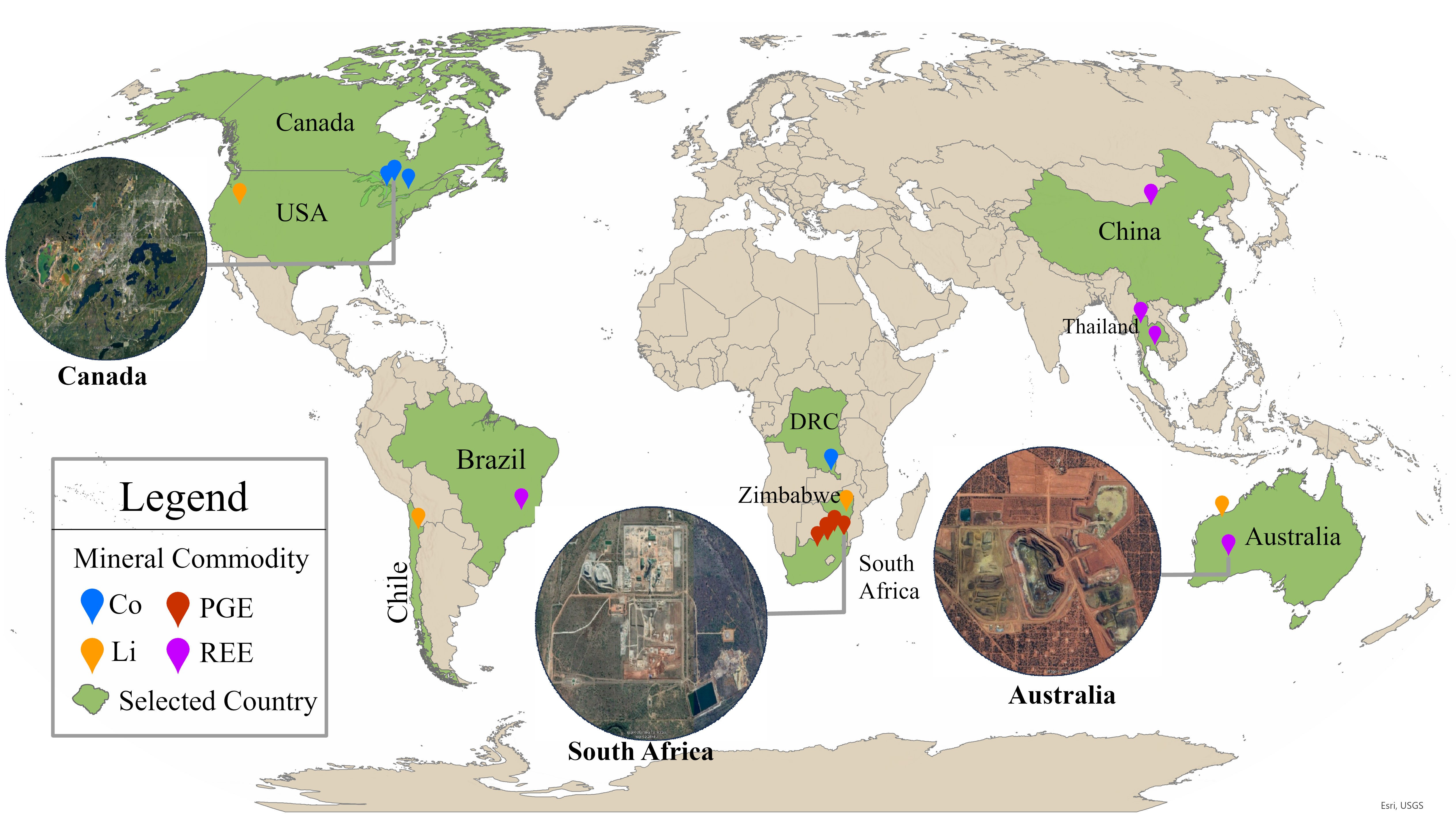
The purpose of this paper is to leverage the growth of AI-enabled tools to support the democratization of mine observation (MO) research. Mining is essential to meet projected demand for renewable energy technologies crucial to global climate mitigation objectives, but all mining activities pose local and regional challenges to environmental sustainability. Such challenges can be mitigated by good governance, but unequal access among stakeholders to accurately interpreted satellite imagery can weaken good governance. Using readily available software—QGIS, and Segment Anything Model (SAM)—this paper develops and tests the reliability of MO-SAM, a new method to identify and delineate features within the spatially-explicit mine extent at a high level of detail. It focuses on dry tailings, waste dumps, and stockpiles in above-ground mining areas. While we intend for MO-SAM to be used generally, this study tested it on mining areas for energy-critical materials: lithium (Li), cobalt (Co), rare earth elements (REE), and platinum group elements (PGE), selected for their importance to the global transition to renewable energy. MO-SAM demonstrates generalizability through prompt engineering, but performance limitations were observed in imagery with complex mining landscape scenarios, including spatial variations in image morphology and boundary sharpness. Our analysis provides data-driven insights to support advances in the use of MO-SAM for analyzing and monitoring large-scale mining activities with greater speed than methods that rely on manual delineation, and with greater precision than practices that focus primarily on changes in the spatially-explicit mine extent. It also provides insights into the importance of multidisciplinary human expertise in designing processes for and assessing the accuracy of AI-assisted remote sensing image segmentation as well as in evaluating the significance of the land use and land cover changes identified. This has widespread potential to advance the multidisciplinary application of AI for scientific and public interest, particularly in research on global scale human-environment interactions such as industrial mining activities. This is methodologically significant because the potential and limitations of using large pre-trained image segmentation models such as SAM for analyzing remote sensing data is an emergent and underexplored issue. The results can help advance the utilization of large pre-trained segmentation models for remote sensing imagery analysis to support sustainability research and policy.
Published at: PLOS Sustainability and Transformation, 2025.
Bibtex
@article{10.1371/journal.pstr.0000182,
doi{10.1371/journal.pstr.0000182,
author = {Wang, Qitong AND Chinkaka, Emmanuel AND Richaud, Romain AND Haghdadi, Mehrnaz AND Wolk, Coryn AND Oromeng, Kopo V. AND Davis, Kyle Frankel AND Bianco, Federica B. AND Peng, Xi AND Klinger, Julie Michelle},
journal = {PLOS Sustainability and Transformation},
publisher = {Public Library of Science},
title = {MO-SAM: Testing the reliability and limits of mine feature delineation using Segment Anything Model to democratize mine observation and research},
year = {2025},
month = {07},
volume = {4},
url = {https://doi.org/10.1371/journal.pstr.0000182},
pages = {1-25},
number = {7},
}